

Condition des communautés d’habitats benthiques: Approche conceptuelle commune
D1 - Diversité Biologique D5 - Eutrophisation D6 - Intégrité des fonds marins
D1.6 - Condition des habitats D5.3 - Effets indirects de l’enrichissement en nutriments D6.2 - Condition des communautés d’habitats benthiques
Message clé:
Les habitats benthiques sont essentiels pour la vie marine. L’évaluation de leur condition par rapport à tous les types de pression présente un défi nouveau et important sur le plan de la science et de la gestion. Les résultats de l’évaluation préliminaire sont disponibles pour deux types de pression. Le développement ultérieur de cette approche commune intègrera les résultats de l’évaluation et comprendra des types supplémentaires d’habitat et de pression.
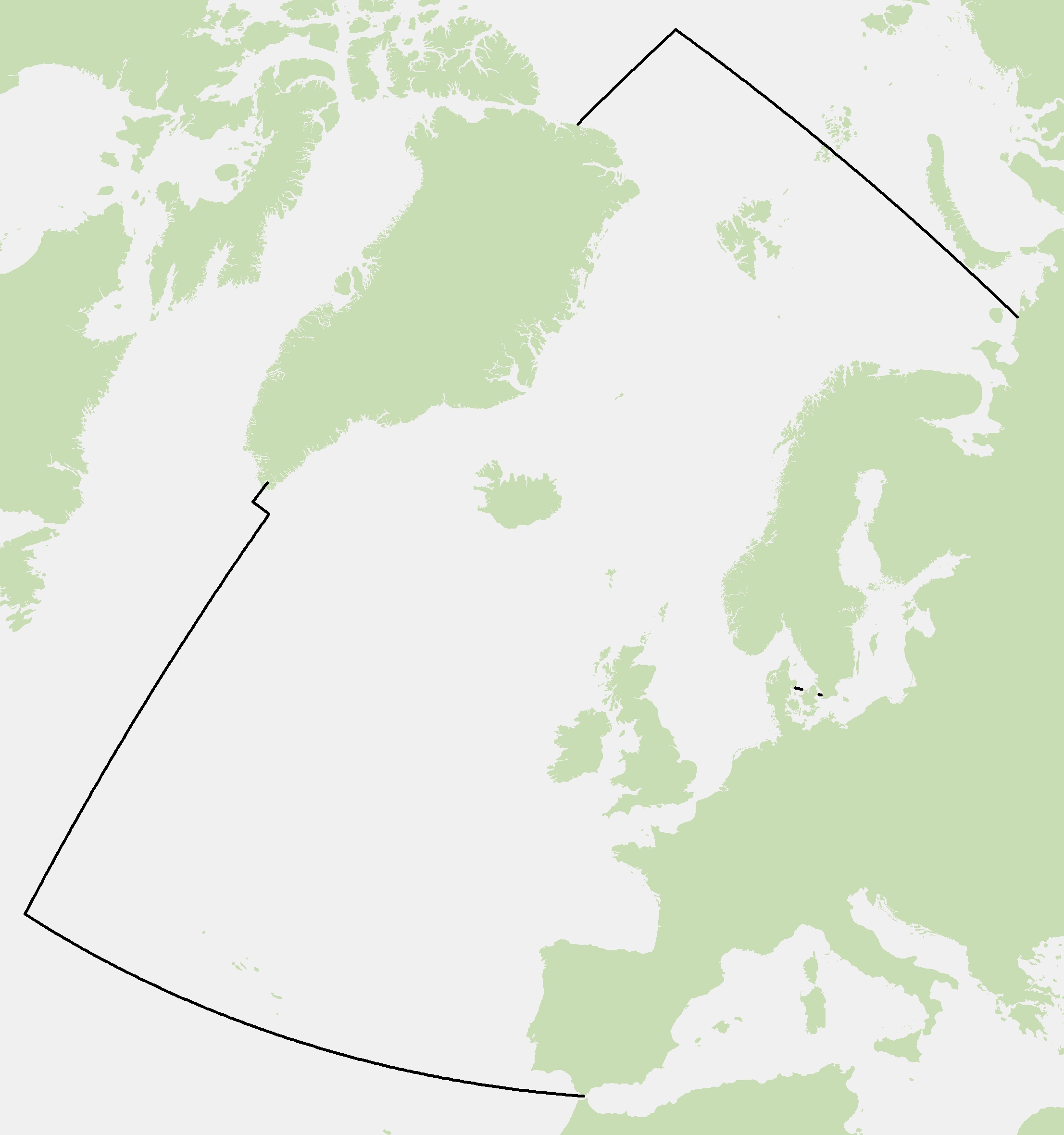
Area assessed
Printable summary
Contexte
Les habitats benthiques sont essentiels pour la vie marine car les espèces marines dépendent directement ou indirectement du sol marin pour s’alimenter, se cacher, se reposer ou se reproduire. Les habitats benthiques se caractérisent par des communautés animales ou végétales d’une mobilité inexistante ou limitée par rapport au poisson ou aux mammifères marins. Toute la communauté benthique est donc affectée lorsque des pressions sont exercées. La condition (qualité écologique) des habitats benthiques reflète donc les effets conjugués de toutes les pressions qu’ils subissent.
Cette étude présente le concept d’une approche commune appliquée à l’évaluation des habitats benthiques et de leurs communautés. L’application de cette approche commune a été entérinée par OSPAR pour la mer du Nord au sens large, les mers Celtiques, et le golfe de Gascogne et la côte ibérique grâce à l’adoption d’un indicateur commun. On reconnaît que l’évaluation de l’impact de chaque pression anthropique sur la condition de chaque type d’habitat benthique, le long d’un gradient pression-impact, exige une méthodologie et des échelles d’évaluation spécifiques (Tableau 1). Il s’agit d’informer la gestion des activités humaines, en comprenant le mieux possible les effets relatifs des diverses pressions exercées sur les habitats benthiques et leurs communautés. Par exemple quels sont les habitats affectés, où se situent-ils, dans quelle mesure et pendant combien de temps sont-ils affectés?
Les évaluations, à l’échelle d’OSPAR, des habitats benthiques sont encore à des stades précoces de développement et ce concept sera mieux élaboré avant le prochain Bilan de santé OSPAR et les évaluations suivantes.
| A | Evalués et notifiés dans le cadre de la Directive cadre sur l’eau (DCE) de l’Union européenne |
| Envisagés dans le cadre de la Directive cadre stratégie pour le milieu marin (DCSMM) | |
| P | Evalués partiellement dans l’évaluation intermédiaire de 2017 |
| Principaux risques (potentiellement répandus dans l’ensemble de la zone maritime OSPAR) | |
| Rapports identifiés mais pas évalués actuellement |
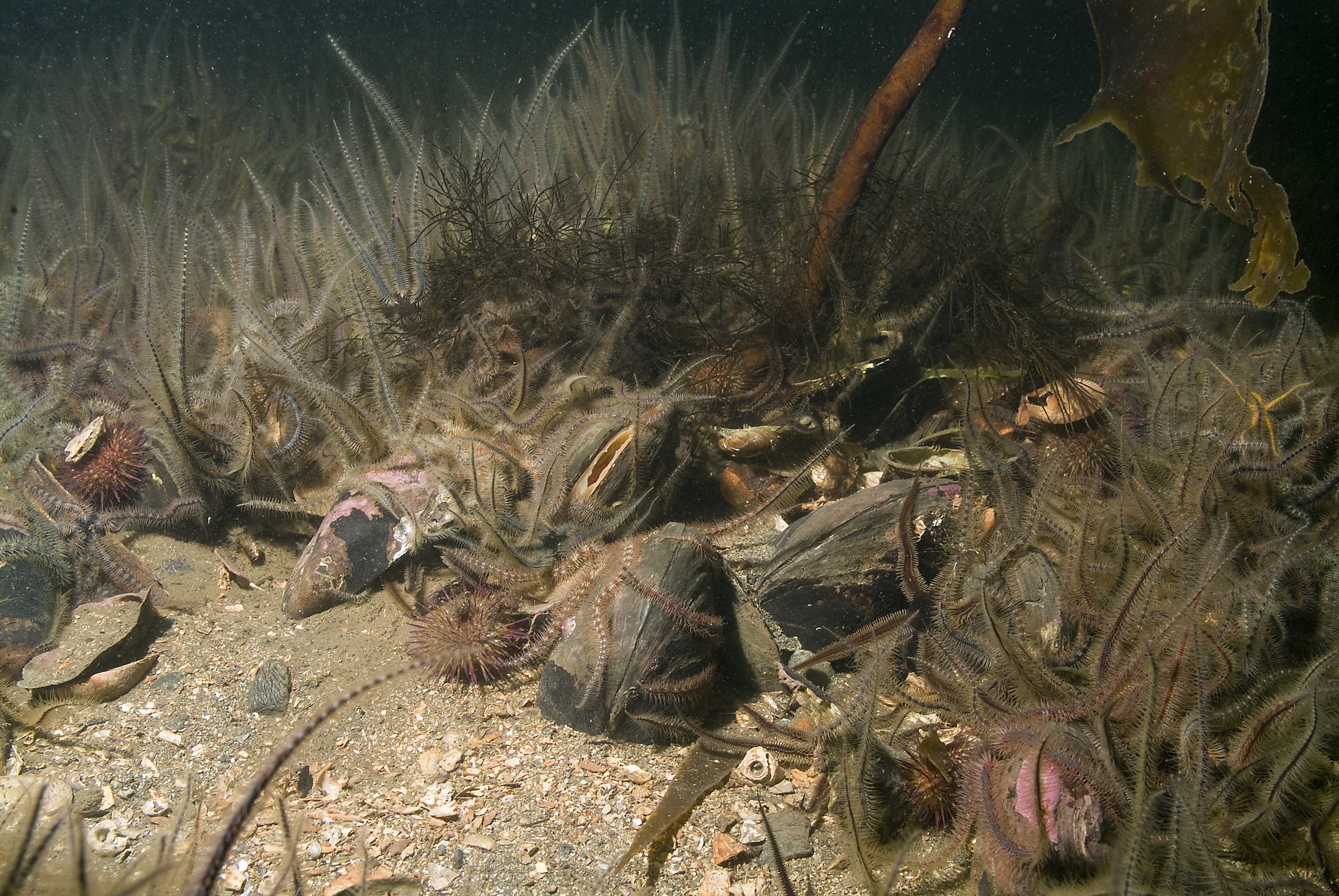
Benthic Habitat (courtesy of Scottish Natural Heritage)
| Grands types d’habitat | Grands types de pression | |||||||
|---|---|---|---|---|---|---|---|---|
| Perturbations physiques | Retrait d’espèces | Modifications hydrologiques | Eutrophisation (nutriments ou matière organique) | Espèces non indigènes | Contaminants | Déchets | Energie notamment bruits sous-marins | |
| Roches et récifs biogènes intertidaux | A | |||||||
| Sédiments intertidaux | A | |||||||
| Roches et récifs biogènes infralittoraux | A | |||||||
| Sédiments infralittoraux | P | A | ||||||
| Roches et récifs biogènes circalittoraux | A | |||||||
| Sédiments circalittoraux | P | A | ||||||
| Roches et récifs biogènes circalittoraux du large | ||||||||
| Sédiments circalittoraux du large | P | P | P | |||||
| Roches et récifs biogènes du bathyal supérieur | ||||||||
| Sédiments du bathyal supérieur | ||||||||
| Roches et récifs biogènes du bathyal inférieur | ||||||||
| Sédiments du bathyal inférieur | ||||||||
| Abyssal | ||||||||
Use of this common approach to evaluate the quality of benthic habitat communities, according to each pressure type along a pressure-impact gradient, has been endorsed for the Greater North Sea, Celtic Seas, and Bay of Biscay and Iberian Coast. Preliminary testing demonstrated that it is conceptually applicable to all habitat types but has only been applied to selected habitat types for the Intermediate Assessment (IA) 2017. Further testing is required to conclude on the relevance and performance of each metric and statistical index, depending on the habitat and pressure types assessed (Table 1).
The colours in the table matrix identify where a particular pressure versus habitat relationship is considered within European Union Directives. The ambition of this indicator is both to draw on existing assessments and to complement this material with new data and knowledge in order to provide better understanding of the overall condition of the benthic habitat community.
Biological and environmental data are quantitatively sampled (such as by grabs, cores, quadrat) at community scale (for example, at least at EUNIS Level 5 for sublittoral sand or infralittoral rocks). The EUNIS habitat classification is a system to classify types of habitat at several nested levels. The higher the level, the more detail and sub-types of habitat are included.
Table 1 identifies the main pressures, with the potential for widespread impacts, for each habitat type at EUNIS (European Nature Information System) Level 2 in the OSPAR Maritime Area. The broad pressure and habitat types (EUNIS Level 2) presented in Table 1 are summarised, however to assess the condition of habitats versus pressures in the marine environment, relationships should be considered at a finer scale. Monitoring, assessment and reporting should be completed per pressure and habitat type. The cumulative effect of co-occurring pressures (different types of pressure at the same place and in the same time range) is not currently assessed.
This indicator aims to assess and quantify the relationship between state and pressure. The indicator requires the following types of data, at relevant and compatible spatial and temporal scales: biological data (community species abundance), environmental data (substrate and water characteristics), and pressure data (type, intensity, frequency).
Monitoring and assessment scale should be adapted depending on each habitat and pressure type, from the site scale (100 m) to regional assessment scale (100 km).
The technical principle underpinning this assessment is to detect and quantify the impact of a pressure by a deviation (of values of the computed statistical index) compared to (simultaneously assessed) reference stations (defined as under least-damage condition), per habitat type.
Diversity indices and species richness indices as well as sensitivity / tolerance species classification systems have long been used to assess the qualitative state of benthic habitat communities. The development of Benthic Indices (BI), which combine the aforementioned indices and classifications, was made mandatory by the Water Framework Directive (WFD). Species composition and relative abundance of the benthic habitat community are basic common metrics. Multi-metric BI classically contain diversity indices, species richness indices and / or proportions of sensitive, tolerant and opportunistic species. Species sensitivity is a proxy used to quantify disturbance for some pressures on a benthic habitat community: either as a direct or indirect effect of nutrient and / or organic enrichment, oxygen depletion, sand extraction or hydrological changes. This requires a good knowledge (for the communities and species assessed) of natural spatial and temporal scales of variation and sensitivity to a specific pressure gradient.
In order to undertake an assessment to meet OSPAR and European Union Marine Strategy Framework Directive (MSFD) requirements, there are many gaps in knowledge of benthic habitats that require research, for example benthic habitat community and sensitivity classification for several habitats types and the characteristics of pressure types (for example, physical, contaminants and biological pressures).
Multi-dimensional deviation in community structure from a reference condition, aims to link pressure (for management issues) and pressure-impact calibration of indices (level of disturbance / resilience). This is set up with various pressures types at the community level, by combining biological and pressure data. Analysis of sensitivity is then elaborated at community level rather than species level. This is an important distinction and a point of attention for further development by experts and implementation for management issues (i.e. specific parameters / metrics to be monitored).
The collection of biological, environmental and (semi-) quantitative pressure data along a pressure gradient is a key step to calculate this metric and to validate the pressure-impact evaluation for an effective multi-metric index.
This common approach has the potential to assess a wide range of environmental aspects and provide more information by looking at them together, than could be gained from assessing each aspect individually.
Further framework development for this indicator (methods, monitoring, data flows) is needed to address all potential MSFD / OSPAR purposes. This indicator should include a necessary flexibility (both for metrics and indices) to take into account the wide range of applications to different habitat types, to target offshore habitats and to assess sensitivity / tolerance to various pressure types.
Further sub-assessments (on contaminants and sediment extraction or dumping) are being developed outside the IA 2017, and are likely to be incorporated into future OSPAR assessments. Future assessments would then be combined as components of an ‘umbrella’ assessment to provide an overall view of the condition of benthic habitats in the North-East Atlantic.
The sub-assessment sheets (for example ‘ Condition of Benthic Habitat Communities: Subtidal Habitats of the Southern North Sea ') will follow specific assessment methodology depending on the habitat and pressure types. For the purposes of the IA 2017, this assessment sheet sets out the proposed method for assessment of the indicator overall.
This indicator needs to be developed in close coordination with other benthic indicators, to ensure complementarity and avoid redundancies, that is, ‘typical species composition’, ‘physical damage of predominant and special habitats’ and other indicators that are still under development (such as ‘area of habitat loss’ and ‘size-frequency distribution of bivalve or other sensitive / indicator species’).
Guidelines for generic monitoring and assessment methods are currently being developed and will be described in the CEMP guidelines (OSPAR, in prep.), which will include detailed technical specifications. This section will be updated in 2018 to reflect these changes.
Technical specification of all common OSPAR benthic habitat indicators and detailed methods and testing results will be described in OSPAR CEMP Guidelines (OSPAR, in prep.). These documents are regularly updated, according to the work conducted for the development, testing and implementation of this indicator. An applied research programme: The ecosystem approach to (sub) regional habitat assessments EcApRHA project was a co-financed European Union project coordinated by OSPAR to address gaps in biodiversity indicator development. It has enabled the further development of this indicator. In addition the EcApRHA project has enabled links between indicators (methods, scales, monitoring and data requirements), including investigation of an integrated method for an overall assessment of benthic habitat, to be developed.
Résultats
Seules deux interactions, condition par opposition à pression, possèdent des méthodologies suffisamment développées et des données disponibles pour pouvoir entreprendre des évaluations selon l’approche conceptuelle commune pour l’évaluation intermédiaire (IA) de 2017. Il s’agit des habitats côtiers par rapport à l’enrichissement en nutriments et/ou organique et la diversité des espèces dans les sédiments subtidaux dans la mer du Nord méridionale par opposition à l’abrasion (par la pêche au chalut de fond).
A l’avenir, l’évaluation des habitats benthiques comprendra les résultats de toute une gamme d’évaluations de pressions spécifiques afin de mieux comprendre les pressions exercées sur le sol marin. Chaque série de résultats sera différente selon le type de pression (et donc l’échelle d’évaluation correspondante) considéré. Les effets cumulatifs des pressions s’exerçant ensemble (divers types de pression exercée au même endroit et pendant la même période) ne sont pas évalués actuellement. Un développement plus poussé aura lieu au cours du prochain cycle d’évaluation (selon les avancées du développement de méthodes permettant d’intégrer les évaluations et d’autres indicateurs) afin d’obtenir une compréhension générale de la condition des habitats benthiques dans l’Atlantique du Nord-Est. Les avancées du développement de l’évaluation des effets cumulatifs sont également abordées dans le cadre des perspectives de l’évaluation des écosystèmes.
Conclusion
L’évaluation de la condition des habitats benthiques par rapport à tous les types de pression au sein de la zone maritime OSPAR présente un défi nouveau et important sur le plan de la science et de la gestion. Les experts impliqués dans les conventions des mers régionales ont développé, en quelques années seulement, des approches communes appliquées à l’évaluation des effets de chaque type de pression.
Actuellement, deux interactions pressions-habitats ont été évaluées selon l’approche conceptuelle commune mais les travaux portant sur le développement de l’évaluation d’autres types d’habitat et de pression sont prometteurs. Il y a lieu d’entreprendre des travaux supplémentaires pour aborder les lacunes des connaissances, la surveillance et flux de données nécessaires afin de s’assurer que les données sont suffisantes et adéquates pour pouvoir réaliser une évaluation effective à l’échelle de la région. La valeur ajoutée d’une approche commune pour l’évaluation de la condition des communautés d’habitats benthiques sera réalisée grâce à son application en conjonction avec d’autres indicateurs benthiques. Ceci permettra de mieux comprendre l’ampleur des effets des pressions exercées sur les habitats benthiques: c’est-à-dire quels sont les habitats affectés, oú se situent-ils, dans quelle mesure et pendant combien de temps sont-ils affectés? Davantage de données exhaustives et le développement de méthodes d’évaluation des interactions supplémentaires pression-habitat devraient, à l’avenir, fournir des signes plus clairs et identifier des tendances plus nettes pour informer les besoins de gestion.
This indicator will require further development for the next assessment cycle, to include additional condition versus pressure relationships (for all OSPAR and European Union Marine Strategy Framework Directive (MSFD) purposes). An action plan to achieve this is summarised and referred in the knowledge gaps (extended) section and in EcApRHA action plan.
Application to Arctic Waters and the Wider Atlantic seems conceptually possible and feasibility could be further tested if relevant datasets are made available.
Depending on prioritisation of habitat / pressure types to be assessed in each sea area, and available resources and monitoring (and pressure data), this indicator could be progressively implemented towards its full potential.
This indicator does not aim to cover spatially all geographical areas of a sub-region, which would imply high monitoring costs. For a wide sub-regional scale assessment, this indicator will have to be used in combination with the indicator Extent of Physical Damage to Predominant and Special Habitats . The results from this assessment could be used to better design (and increase efficiencies) in monitoring. Furthermore, the application of a ‘risk-based’ approach allows for cost-efficiencies, through ground-truthing and quantifying potential impacts, which can then be extrapolated to the assessment of wide-scale disturbances.
The detailed technical method to combine these Indicators, for an integrated assessment, is still under development (refer to knowledge gaps, extended section) but the principle is to use this indicator to calibrate (quantify) the state / pressure relationship used in matrices for large-scale assessment, for each habitat and pressure type. For this assessment cycle, the effect of co-occurring pressures is not assessed, because the effect of each pressure type has to be understood before studying multiple effects. By considering numerous pressure types, the impacts from individual pressures are more difficult to distinguish and thus the implementation of adequate management measures is challenging. Partitioning individual pressures per habitat type enables the identification and exploration of individual threats to specific habitat types, and for targeted management to be implemented where required.
Lacunes des connaissances
Il y a lieu de développer plus avant les méthodologies permettant d’adapter, de rendre opérationnelle et de mettre en œuvre, de manière cohérente, cette approche conceptuelle commune pour tous les types de pression et d’habitat. Cet indicateur est prometteur mais il devra être développé et testé plus avant pour être pleinement opérationnel à toutes les fins d’OSPAR et de la DCSMM pour la prochaine évaluation. Un plan d’action abordant certaines de ces lacunes des connaissances a été adopté à la suite du projet EcApRHA d’OSPAR.
The need for further method development, and the lack of adequate data or access to existing data (biological, environmental, pressure), compromise the establishment of clear and accurate state-pressure relationships, and thus the possibility to define accurate assessment values at the OSPAR scale. However, such an assessment could be undertaken in those areas where there is sufficient data. The lack of data is due to both lack of appropriate monitoring (for example, for offshore habitats) and barriers to data flows.
Barriers and Gaps
Method Development
Baseline data (‘reference’ with low or least disturbance) are lacking at the OSPAR scale for many habitats exposed to abrasion by bottom-trawling fisheries. This compromises our ability to identify a sustainable condition for those habitats, which are under continuously high pressure levels. ‘Pristine’ baselines (no disturbance) are lacking for most of the habitats; this compromises our knowledge of the potential best condition of natural habitat communities. It is not practical or feasible to use this pristine state as an environmental target everywhere, but it is useful for understanding the natural dynamic and recovery potential of a given habitat. Increasing the establishment and management of Marine Protected Areas (including Marine Natura 2000 sites), notably including ‘no take or low pressure areas’ could help provide data in the future, for the relevant habitat types.
Cumulative Effects
The cumulative effect of co-occurring pressures (different types of pressure at the same place and in the same time range) is not currently assessed. According to the actual gaps in knowledge on benthic habitat communities, it will be necessary to first understand and quantify the effects of each pressure type, where data are available, before investigating and understanding the effects of cumulative pressures (such as whether they are synergistic or antagonistic). This is an important requirement because many habitats are exposed to multiple pressures. Monitoring of benthic habitats exposed to cumulative pressures, where management measures aim progressively for a more sustainable use, even for one pressure type, would help to better understand this in the future.
Data Use and Availability
Many potentially relevant data exist but are not all available (e.g. fishing pressure data at fine spatial resolution, or biological data from marine research and marine industry).
Many biological datasets exist, but few have associated data on pressure at a compatible spatial and temporal scale.
Most OSPAR Contracting Parties undertake large-scale marine benthic monitoring (at least for the European Union Water Framework Directive). Finer scale networks of state-pressure relationship assessment areas are more heterogeneous and should be further investigated. Developing coordinated monitoring – or better still, joint monitoring – would be more cost-efficient and would ensure coherence and robustness for an assessment at a sub-regional scale.
Each country currently stores its own monitoring data, so common methodology (and tools) still needs to be developed. The need for this should be anticipated and relevant work should be coordinated at a sub-regional scale to ensure coherence and facilitate the computation of data for indicator assessment.
Cost-effectiveness
This common approach is an ‘umbrella’ for several sub-assessments. It is based on existing and anticipated monitoring requirements (for OSPAR, the European Union Marine Strategy Framework Directive (MSFD), other European Directives, and the Common Fisheries Policy) and will therefore be cost-efficient if coordinated.
Further Development and Roadmap
The indicators for ‘ Condition of Benthic Habitat Communities’ and ‘ Extent of Physical Damage to Predominant and Special Habitats ’, are the only OSPAR-wide commonly agreed benthic habitat indicators. A regional (wide-scale) monitoring strategy and technical guidance are partly in place and implemented for some coastal habitats and for nutrient input pressure (European Union Water Framework Directive (WFD)). This monitoring strategy should be further coordinated, extended offshore and adapted for (finer-scale) assessment areas, to progressively take into account and assess effects of other types of pressure on each benthic habitat type. As geographical (nested) scales are identified, assessment methods would be progressively adapted and described.
An action plan identifying gaps, barriers and solutions to further develop OSPAR benthic indicators, and an integrated assessment for the next assessment cycle, is available in EcApRHA (ecosystem approach to (sub) regional habitat assessments) research programme deliverables.
In future assessments, consideration could be given to applying this common approach to other habitat types, such as those listed in the European Union Habitats Directive, and on OSPAR’s List of Threatened and/or Declining Species and Habitats (OSPAR Agreement 2008-06).