

Status Assessment 2023 - Intertidal Mudflats
| Distribution | Extent | Condition | Previous OSPAR status assessment | Status (overall assessment) | ||||||
|---|---|---|---|---|---|---|---|---|---|---|
| Region | I | ? | ? | ? | ● | ? | ||||
| II | ←→ | 1,3 | ←→ | 1,3 | ←→ | 3,5 | ● | Poor | 3,5 | |
| III | ←→ | 1,3,5 | ←→ | 1,2,3,5 | ↓ | 3 | ● | Poor | 3 | |
| IV | ←→ | 3 | ? | ←→ | 3,5 | ● | Poor | 3,5 | ||
| V | NA | NA | NA | NA | NA | |||||
Notes:
Pressures
Mudflat pressures were taken from OSPAR Quality Status Report 2010 and EU Habitat Directive Article 17 reporting on habitat types 1140 (‘mudflats and sandflats not covered by seawater at low tide’) and 1130 (‘estuaries’).
The table was filled by combining the country specific answers per region of the Contracting Parties.
(*) from QSR2010, plus addition pressures (+) from HD report on 1140 and 1130 (2019) (https://nature-art17.eionet.europa.eu/)
Explanation to table:
Distribution, Population size, Condition
Trends in status (since the assessment in the background document)
↓ decreasing trend or deterioration of the criterion assessed
↑ increasing trend or improvement in the criterion assessed
←→ no change observed in the criterion assessed
? trend unknown in the criterion assessed
Previous status assessment: If in QSR 2010 then enter Regions where species occurs (○) and has been recognised by OSPAR to be threatened and/or declining (●) based on Chapter 10 Table 10.2 and Table 10.3 . If a more recent status assessment is available, then enter ‘poor’/’good’
Status*(overall assessment)
red – poor
green – good
? – status unknown
NA - Not Applicable
*applied to assessments of status of the feature or of a criterion, as defined by the assessment values used in the QSR 2023 or by expert judgement.
Key Pressure
↓ key pressures and human activities reducing
↑ key pressures and human activities increasing
←→ no change in key pressures and human activities
? Change in pressure and human activities uncertain
Threats or impacts (overall assessment)
red – significant threat or impact;
green–no evidence of a significant threat or impact
Blue cells – insufficient information available
NA – not applicable
1 – direct data driven
2 – indirect data driven
3 – third party assessment, close-geographic match
4 – third party assessment, partial-geographic match
5 – expert judgement
| *Habitat damage & loss | *Hydrographical changes | *Hazardous substances | *Oil pollution | *Climate changes | Introduction of non-indigenous species and translocations | Removal of target and non-target species | Nutrient and organic enrichment | Threat or impact | ||||||||||
|---|---|---|---|---|---|---|---|---|---|---|---|---|---|---|---|---|---|---|
| Region | I | ? | ? | ? | ? | ? | ? | ? | ? | ? | ||||||||
| II | ? | 1,2,3,5 | ? | 2,5 | ? 2,5 | ?2,5 | ? | ↑ | 2,5 | ? | 3,5 | ? | 2,5 | ? | ||||
| III | ? | 3,5 | ? | 1,2,5 | ? | 2 | ?1,2 | ?1 | ?1,5 | ?1,2 | ?1,2 | ? | ||||||
| IV | ←→ | 2 | ←→ | 2 | ↓ | 2 | ←→ | 2 | ? | ←→↑ | 1 | ←→ | 2 | ←→ | 2 | ? | ||
| V | ? | ? | ? | ? | ? | ? | ? | NA | NA | |||||||||
Confidence
Medium: The confidence in this assessment is medium. A lot of information has been taken from the EU Habitats Directive (HD) Article 17 assessments (2019) (Figure 1 and Figure 2), which cover broader habitats (1140 and 1130) than the OSPAR-habitat (Figure 3). The OSPAR area is broader however. Relevant EU Member States are: SE, DK, DE, NL, UK (still in 2018), IE, FR, ES, PT. Non-EU members are IS and NO.
Figure 1 also shows that different countries report differently for the same HD assessment, since colours are largely specific to countries (IE orange, UK red, NL orange, DE green, etc) for unknown reasons. In general, however, the habitat is well visible, presumably leading to a good confidence in conclusions on extent and distribution (in contrast to e.g., deep sea habitats), but not always well monitored in terms of condition and threats (less certain conclusions). Finally, not all Contracting Parties were able to deliver input; the reasons for this are unknown.
- Relation between EU Habitat Directive habitat types 1140, 1130 and OSPAR mudflats:
The conclusions on this habitat type are largely based on the HD 1140 and 1130 Article 17 reporting, and further detailed based on information delivered by Contracting Parties. Assessments on HD scale may imply some room for error, because HD conclusions may be valid for a broader habitat type then the OSPAR mudflats (Figure 3). Therefore, an attempt has been made to correct the general conclusions with Contracting Party-specific input of specialists.
- Conclusions:
For the EU HD Art 17 assessments themselves, the integration of assessment criteria is based on the One Out All Out principle (if one criterion scores bad, and the others good, the final result is scored bad, in contrast to e.g., averaging all scores to obtain a final score) (Borja et al. 2013, 2014, Barnard & Strong 2014, Probst & Lynam 2016), although it can be over-ridden or modified with expert judgement weighted for area/importance/value of separate contributions (Barnard & Strong 2014).
The Article 17 reports treat pressures and threats status separately, but without trend indication. The following ‘translation’ rules were applied:
- If pressure is assessed identical for status and threat:
trend = no change
- If pressure is assessed higher for status than for threat (or not at all for threat): trend = decline
- If pressure is assessed lower (or not at all) for status than for threat: trend = increase
Background Information
Year added to OSPAR List: 2003 (OSPAR 2009). Case report (OSPAR, 2008) providing the justification for species inclusion in the list:
(https://www.ospar.org/site/assets/files/44271/intertidal_mudflats.pdf)
Key criteria that led to the listing in 2003:
- Decline: Reduction in the area of intertidal mudflats has occurred in many parts of the OSPAR area mainly due to land claim, infrastructure development and spread of the cordgrass Spartina anglica.
- Sensitivity: Mudflats are naturally resilient and can recover well from isolated physical and chemical disturbances, except from oil pollution. However, once the habitat disappears the process is irreversible.
- Ecological significance: Intertidal mudflats provide feeding and resting areas for waterfowl and nursery- and feeding areas for fish. Other functions mentioned are protection against coastal erosion, its role in nutrient chemistry and sequestration of contaminants.
- Key pressures affecting intertidal mudflats are (QSR 2010): Climate changes; Hydrographical changes; Hazardous substances; Oil pollution; Habitat damage; and Habitat loss.
- Knowledge gaps: In QSR 2010 it was recommended to further harmonise data collection on these habitats since it was not possible to determine the exact extent (including loss) and condition of this habitat.
- This habitat largely overlaps with the EU Habitat Directive habitat type 1140 (mudflats and sandflats not covered by seawater at low tide) (only the mudflats part) and partly with 1130 (estuaries).
. Green: FV (Favourable): A habitat is in a situation where it is prospering and with good prospects to do so in the future as well; Orange: U1 (Unfavourable-Inadequate): A habitat is in a situation where a change in management or policy is required to return the habitat to favourable status but there is no danger of disappearance in the foreseeable future; Red: U2 (Unfavourable-Bad): A habitat is in serious danger of disappearing (at least regionally); Grey: XX (Unknown): The information available for the habitat type is scarce and does not allow a proper assessment of its conservation status (Map source: https://maps.eea.europa.eu/)")
Figure 1. Status of habitat type 1140 ‘mudflats and sandflats not covered by seawater at low tide’, HD Article 17 summary report by EEA). Green: FV (Favourable): A habitat is in a situation where it is prospering and with good prospects to do so in the future as well; Orange: U1 (Unfavourable-Inadequate): A habitat is in a situation where a change in management or policy is required to return the habitat to favourable status but there is no danger of disappearance in the foreseeable future; Red: U2 (Unfavourable-Bad): A habitat is in serious danger of disappearing (at least regionally); Grey: XX (Unknown): The information available for the habitat type is scarce and does not allow a proper assessment of its conservation status (Map source: https://maps.eea.europa.eu/)
. For explanation of colours, see Figure 1")
Figure 2. Status of habitat type 1130 ‘estuaries’, HD Article 17 summary report by EEA: https://maps.eea.europa.eu/). For explanation of colours, see Figure 1
Geographical Range and Distribution
In the HD Article 17 reporting on 1140 and 1130, over the period 2013-2018 the range of the habitat was considered favourable and stable (BE, DE, DK, ES, FR, IE, NL, PT, SE, UK). According to the Article 17 Habitats Directive Assessment Reports on 1140 the overall range status is favourable. (https://nature-art17.eionet.europa.eu/article17/habitat/summary/)
Data specifically delivered for this assessment by individual Contracting Parties indicate that the extent shows (local) declines in FR and UK Wales.
")
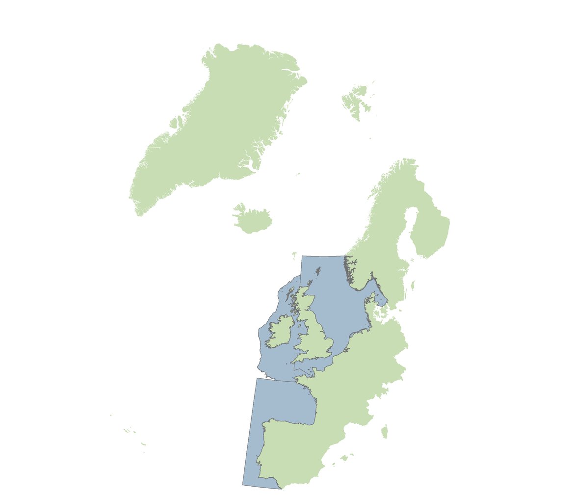
Figure 3: Data from the OSPAR data portal 2020 on distribution of intertidal mudflats. (Source: https://emodnet.ec.europa.eu/en/ospar-threatened-andor-declining-habitats-spatial-dataset)
Method of assessment: 1,2,5
Extent
This habitat is present in a vast number of estuaries, bays and inlets in the OSPAR maritime area, each with their own specific environmental and management conditions (OSPAR Commission 2009). In the last status assessment (QSR 2010), it was reported that the full extent of this habitat and its loss in extent over time is not fully documented for most Contracting Parties. Since then, the known surface area has increased due to improved mapping. However, the habitat extent is probably still larger than reported so far (Figure 3).
Over the period 2013-2018 the area of the habitat was considered favourable and stable in BE, DK, FR, DE, IE, NL and SE) (Article 17 Habitats Directive Assessment Reports). For PO, ES and the UK, the extent was assessed as unknown. According to the Article 17 Habitats Directive Assessment Reports, the area status is still unknown (49% favourable; 51% unknown).
In more detail and additional to the HD assessment, OSPAR Contracting Parties (UK Wales, France) report a decrease in extent.
Method of assessment: 1, 2, 3, 4, 5.
Condition
The HD Article 17 reporting 2013-2018 for habitats 1140 and 1130 shows:
- unfavourable and decreasing condition in IE and UK,
- unfavourable and unknown trend in NL and ES
- stable but unfavourable condition for both habitat types in DK, FR, PT, SE
- Stable and favourable in DE (apart from 1130)
Method of assessment: : 3 (Region II, III and IV)
Threats and Impacts
Intertidal mudflats are easily impacted because of their location between land and sea. Main threats according to background document (OSPAR, 2009) and based on input of Contracting Parties are:
- Coastal developments such as urban and transport infrastructure and for industry, causing: physical removal of the habitat; food web effects; toxic effects (effluent discharges on industrialised and urbanised estuaries and coastlines may contain contaminants); organic enrichment effects (e.g., increased coverage by opportunistic green macroalgae resulting in the formation of green tide mats causing anoxic conditions below the mats). For example, in Sweden the nutrient load is still at a very high level but due to improved sewage treatment, the Water Framework Directive and other directives the actual annual input of N and P, e. g., by river runoff, has decreased.
- Oil spills from e.g., ship accidents, which may cause pollution (accumulation) and anoxia resulting in the death of infauna.
- Fishing and bait digging (e.g., suction dredging for shellfish or juvenile flatfish, or by-catch from shrimp fisheries) causing impact on community structure and substratum.
- Climate change, causing sea level rise and increased storm frequency, affecting the sedimentation patterns of mudflats and estuaries, coastal squeeze (e.g., in UK), and changes in exposure time. Climate change also leads to temperature increase resulting in changing ecological interactions between species.
- Invasive species (such as Pacific oyster Magallana gigas (syn. Crassostrea gigas)* in the Wadden Sea: NL, DE, DK or Ensis leii, Mya arenaria, Austrominius modestus, Streblospio benedictii, Neomysis americana in FR).
- Human disturbance (e.g., tourism).
*Magallana gigas is currently considered as a species that provides opportunities to intertidal mussels Mytilus edulis to recover by providing shelter (Folmer et al. 2017).
Measures that address key pressures from human activities or conserve the species/habitat
There are no agreed protocols for intertidal habitat restoration (OSPAR Commission 2009). Artificial mudflats and other compensatory measures are considered not to be a viable compensation since the functional characteristic of artificial mudflats would be rapidly lost without regular maintenance.
Managed Realignment (MR) is a measure to conserve intertidal mudflats and is applied in the UK. MR is the technique of re-locating the land/sea border inland by lowering, removing or breaching the previous defences and constructing new or maintaining previous secondary defences (Dale et al. 2017). Many coastal managers advocate MR as a preferred management strategy (Dale et al. 2017).
Another example of compensation and also mitigation however is the Mud Motor method (NL), where mud (removed for deepening shipping lanes) is deposited upstream of the area to be restored. This can be successful in promoting natural mudflats and saltmarsh development (Baptist et al. 2019).
Instances of protection of intertidal mudflats in Marine Protected Areas in the different Regions are Region I: 2; Region II: 21; Region III: 23; Region IV: 11 (Hennicke et al., 2022). It is concluded that there is MPA replication in all OSPAR Regions where the feature is considered to be under threat/subject to decline (Hennicke et al., 2022).
Collective Actions from the OSPAR recommendation for intertidal mudflats (https://www.ospar.org/documents?d=35391) are:
- Improving the OSPAR mapping database
- Sharing knowledge on intertidal mudflats with stakeholders and other competent international authorities
- Identifying whether further measures to maintain or improve water quality (contaminants and nutrients) are necessary to safeguard relevant habitats and implement if required
Conclusion (including management considerations)
- Compared to the QSR 2010 report, the status of mudflats is still poor in the OSPAR area. While the geographical distribution and extent of the habitat are generally good and stable (in Regions II, III and IV, no data for Region I), with some exceptions, the condition of intertidal mudflats is poor due to human pressures including climate change, nutrient enrichment, invasive species and hydrological changes (e.g., construction).
- The conclusions on this habitat type are largely based on the HD 1140 and 1130 Article 17 reporting, and filled in with more details for these assessments, based on information delivered by Contracting Parties. Assessments on HD scale may imply some room for error, because HD conclusions may be valid for a broader habitat type than the OSPAR mudflats. Therefore, an attempt has been made to correct the general pictures with Contracting Party-specific input of specialists. In general, the habitat is well visible, leading to a good confidence in conclusions on extent and distribution (in contrast to e.g., deep sea habitats), but not always well monitored in terms of condition and threats (less certain conclusions). However, due to its coastal connection, its easily impacted and evidence of e.g., ‘coastal squeeze’, pollution, etc. is well visible and should be managed better where possible. The poor condition justifies keeping the habitat on the OSPAR List.
- In the context of the HD Directive, relevant management measures will be implemented for 1140 and 1130 and improvement will be monitored.
- A re-assessment is advised to be done in the long-term (6-10 y), since HD management measures will need time to result in improvement.
Knowledge Gaps
- sufficiency of data: for a number of areas, data on extent, distribution and threats are lacking. Based on the comparison of HD and OSPAR habitats (although they are not exactly the same) (Figure 4), it is expected that the OSPAR habitat is more widely spread than reported to JNCC now.
, H1130 (purple) and OSPAR mudflats (red) (EMODNET, 2022)")
Figure 4: Comparison of reported distributions of H1140 (orange), H1130 (purple) and OSPAR mudflats (red) (EMODNET, 2022)
Method used
Main source of information:
- OSPAR data assessment only
- Assessment derived from third party assessment
- Assessment derived from a mix of OSPAR data assessment and assessments from third parties
Assessment is based upon:
a) complete survey or a statistically robust estimate (e.g. a dedicated mapping or survey or a robust predictive model with representative sample of occurrence data, calibration and satisfactory evaluation of its predictive performance using good data on environmental conditions across entire species range);
b) based mainly on extrapolation from a limited amount of data (e.g. other predictive models or extrapolation using less complete sample of occurrence and environmental data);
c) based mainly on expert opinion with very limited data;
d) insufficient or no data available.
Assessment carried out by Wageningen Marine Research (Bos, Tamis)
Main source of information:
- Key documents (Background document, Case Report, Recommendations) (OSPAR Commission 2008, 2009, 2016);
- OSPAR status report (QSR, 2010);
- EU Habitat Directive Article 17 reports H1140, H1130 (EU 2019);
- A literature review and;
- A questionnaire send to experts from all relevant contracting parties.
- HD related online databases and mapservers (EEA, EUNIS)
(EEA 2018)
Map viewers and databases HD Art 17 Habitats Directive
- EEA map viewer and Art 17 dataset:
- EUNIS map viewer and databases:
- H1130: EUNIS summary status and map: https://eunis.eea.europa.eu/habitats/10005
- H1140: EUNIS summary status and map: https://eunis.eea.europa.eu/habitats/10006
- EU Article 17 reporting tool:
- https://nature-art17.eionet.europa.eu/article17/habitat/summary/
- EEA summary H1140 https://nature-art17.eionet.europa.eu/article17/habitat/summary/?period=5&group=Coastal+habitats&subject=1140®ion=
- EEA summary H1130 https://nature-art17.eionet.europa.eu/article17/habitat/summary/?period=5&group=Coastal+habitats&subject=1130®ion=
- EEMODNET 2022: Comparison H1140, H1130 and OSPAR intertidal mudflats: https://www.emodnet-seabedhabitats.eu/access-data/launch-map-viewer/?activeFilters=&zoom=5¢er=11.989,49.796&layerIds=1101,1100,801&baseLayerId=-3&activeFilters=NobwRANghgngpgJwJIBMwC4AcAGAjAGjADMBLCAF0VQwCYB2Q0ixAGQHs2BrAVwAdUAzhmC4AnHVwBdRmUoIAKnAAe5DGDABfSUA
Literature
Baptist MJ, Gerkema T, van Prooijen BC, van Maren DS, van Regteren M, Schulz K, Colosimo I, Vroom J, van Kessel T, Grasmeijer B, Willemsen P, Elschot K, de Groot AV, Cleveringa J, van Eekelen EMM, Schuurman F, de Lange HJ, van Puijenbroek MEB (2019) Beneficial use of dredged sediment to enhance salt marsh development by applying a ‘Mud Motor’. Ecol Eng 127:312–323.
Barnard S&, Strong J (2014) Reviewing, refining and identifying optimum aggregation methods for undertaking marine biodiversity status assessments.
Borja A, Elliott M, Andersen JH, Cardoso AC, Carstensen J, Ferreira JG, Heiskanen A-S, Marques JC, Neto JM, Teixeira H, Uusitalo L, Uyarra MC, Zampoukas N (2013) Good Environmental Status of marine ecosystems: What is it and how do we know when we have attained it? Mar Pollut Bull 76:16–27.
Borja A, Prins TC, Simboura N, Andersen JH, Berg T, Marques JC, Neto JM, Papadopoulou N, Reker J, Teixeira H, Uusitalo L (2014) Tales from a thousand and one ways to integrate marine ecosystem components when assessing the environmental status. Front Mar Sci 1.
Cardoso PG, Dolbeth M, Sousa R, Relvas P, Santos R, Silva A, Quintino V (2019) The Portuguese Coast. In: World Seas: an Environmental Evaluation, second. Sheppard C (ed) (Second Press, Academic 2019 Pages 9780128050682, ISBN, p 189–208
Cuvilliez A, Deloffre J, Lafite R, Bessineton C (2009) Morphological responses of an estuarine intertidal mudflat to constructions since 1978 to 2005: The Seine estuary (France). Geomorphology 104:165–174.
Dale J, Burgess HM, Cundy AB (2017) Sedimentation rhythms and hydrodynamics in two engineered environments in an open coast managed realignment site. Mar Geol 383:120–131.
Dauvin JC, Desroy N (2005) The food web in the lower part of the Seine estuary: A synthesis of existing knowledge. Hydrobiologia 540:13–27.
Davis KJ, Binner A, Bell A, Day B, Poate T, Rees S, Smith G, Wilson K, Bateman I (2019) A generalisable integrated natural capital methodology for targeting investment in coastal defence. J Environ Econ Policy 8:429–446.
EEA (2018) Article 17 biogeographical assessments - Methodology Methodology of assessments under Article 17 of the EU.
EU (2019) Article 17 web tool (https://www.eionet.europa.eu/article17/)
Folmer, E., Büttger, H., Herlyn, M., Markert, A., Millat, G., Troost, K., & Wehrmann, A. (2017). Wadden Sea Quality Status Report Beds of blue mussels and Pacific oysters.
Foster NM, Hudson MD, Bray S, Nicholls RJ (2013) Intertidal mudflat and saltmarsh conservation and sustainable use in the UK: A review. J Environ Manage 126:96–104.
Grabemann I, Gaslikova L, Brodhagen T, Rudolph E (2020) Extreme storm tides in the German Bight (North Sea) and their potential for amplification. Nat Hazards Earth Syst Sci 20:1985–2000.
Hennicke, J., Blanchard, S., Chaniotis, P., Cornick, L., Hauswirth, M., Schellekens, T., Vonk, S., and Werner, T. 2022. Report and assessment of the status of the OSPAR network of Marine Protected Areas in 2021. In: OSPAR, 2023: The 2023 Quality Status Report for the North-East Atlantic. OSPAR Commission, London.
Hansen JW, Høgslund S (Red. . (2021) MARINE OMRÅDER 2020. NOVANA.
Hudson, R., Kenworthy, J. and Best, M. (eds) (2021). Saltmarsh Restoration Handbook: UK and Ireland. Environment Agency, Bristol, UK
Van der Heide T, Tielens E, van der Zee EM, Weerman EJ, Holthuijsen S, Eriksson BK, Piersma T, van de Koppel J, Olff H (2014) Predation and habitat modification synergistically interact to control bivalve recruitment on intertidal mudflats. Biol Conserv 172:163–169.
Ladd CJT (2021) Review on processes and management of saltmarshes across Great Britain. Proc Geol Assoc.
Nationalpark Wattenmeer Niedersachen (2022) Anlage 1.2 FFH 001 , Maßnahmenblatt LRT 1140 Vegetationsfreies Schlick- , Sand- und Mischwatt , Stand 01/2022 Mischwatt , Stand 01 / 2022 ( zur Konkretisierung der Aussagen im trilateralen Wattenmeerplan [ 2010 ]). 2022:1–8.
OSPAR (2010a) Quality Status Report 2010. OSPAR Commission. London.176pp. Online version: http://qsr2010.ospar.org/en/index.html.
OSPAR (2017) Intermediate Assessment 2017.
OSPAR (2019) 2018 Status Report on the OSPAR Network of Marine Protected Areas. OSPAR Comm London:1–80.
OSPAR Commission (2008) Case Reports for the OSPAR List of Threatened and/or Declining Species and Habitats: Intertidal mudflats.
OSPAR Commission (2009) Background Document for Intertidal mudflats, Biodiversity Series. OSPAR, London, UK.
OSPAR Commission (2016) OSPAR Recommendation 2016/2 on furthering the protection and conservation of intertidal mudflats in Regions I, II, III and IV of the OSPAR maritime area.
OSPAR Commission (2018). Overview Assessment of OSPAR Recommendation 2010 / 5 on assessments of environmental impact in relation to threatened and / or declining species and habitats. https://www.ospar.org/work-areas/bdc/species-habitats/implementation-of-species-and-habitat-recommendations
Philippe AS, Pinaud D, Cayatte ML, Goulevant C, Lachaussée N, Pineau P, Karpytchev M, Bocher P (2016) Influence of environmental gradients on the distribution of benthic resources available for shorebirds on intertidal mudflats of Yves Bay, France. Estuar Coast Shelf Sci 174:71–81.
Probst WN, Lynam CP (2016) Integrated assessment results depend on aggregation method and framework structure – A case study within the European Marine Strategy Framework Directive. Ecol Indic 61:871–881.
Van Regteren M, Amptmeijer D, de Groot A V., Baptist MJ, Elschot K (2020) Where does the salt marsh start? Field-based evidence for the lack of a transitional area between a gradually sloping intertidal flat and salt marsh. Estuar Coast Shelf Sci 243.
Saint-Béat B, Dupuy C, Agogué H, Carpentier A, Chalumeau J, Como S, David V, De Crignis M, Duchêne JC, Fontaine C, Feunteun E, Guizien K, Hartmann H, Lavaud J, Lefebvre S, Lefrançois C, Mallet C, Montanié H, Mouget JL, Orvain F, Ory P, Pascal PY, Radenac G, Richard P, Vézina AF, Niquil N (2014) How does the resuspension of the biofilm alter the functioning of the benthos-pelagos coupled food web of a bare mudflat in Marennes-Oléron Bay (NE Atlantic)? J Sea Res 92:144–157.
Schleswig-Holstein Landesamt für Landwirtschaft Umwelt und ländliche Räume (2019) Erhaltungszustand der Lebensraumtypen des Anhanges I der FFH-Richtlinie Ergebnisse in Schleswig-Holstein für den Berichtszeitraum 2013-2018 Erhaltungszustand: Einzelparameter und Gesamtzustand.
Törnqvist O, Klein J, Vidisson B et al. (2020) Fysisk störning av grunda havsområden. Kartläggning och analys av potentiell påverkanszon samt regional och nationell statistik angående störda områden. Metria. 337 pp. (In Swedish)
Van der Zee EM, Tielens E, Holthuijsen S, Donadi S, Eriksson BK, van der Veer HW, Piersma T, Olff H, van der Heide T (2015) Habitat modification drives benthic trophic diversity in an intertidal soft-bottom ecosystem. J Exp Mar Bio Ecol 465:41–48.
Sheet reference:
BDC2023/Intertidal mudflats