

Status Assessment 2022 - Deep-sea sponge aggregations
| Assessment of status | Distribution | Extent | Condition | Previous OSPAR status assessment | Status (overall assessment) | |
|---|---|---|---|---|---|---|
Region | I | ←→1,5 | ?3,5 | ↓3,5 | ● | poor |
| II | ←→1,5 | ?3,5 | ↓1,3,5 | ● | poor | |
| III | N/A | N/A | N/A | N/A | N/A | |
| IV | ←→1,5 | ?3,5 | ↓3,5 | ● | poor | |
| V | ←→1,5 | ?3,5 | ↓3,5 | ● | poor | |
| Assessment of threats | Fishing | Climate change | Threat or impact | |
|---|---|---|---|---|
Region | I | ←→1,5 | ?3,5 | ←→5 |
| II | ↓1,5 | ?3,5 | ↓5 | |
| III | N/A | |||
| IV | ↑1,5 | ?3,5 | ↑5 | |
| V | ←→1,5 | ?3,5 | ←→5 | |
Explanation to table:
Distribution, Population size, Condition
Trends in status (since the assessment in the background document)
↓ decreasing trend or deterioration of the criterion assessed
↑ increasing trend or improvement in the criterion assessed
←→ no change observed in the criterion assessed
? trend unknown in the criterion assessed
Previous status assessment: If in QSR 2010 then enter Regions where species occurs ( ○) and has been recognised by OSPAR to be threatened and/or declining (● ) based on Chapter 10 Table 10.1 and Table 10.2 . If a more recent status assessment is available, then enter ‘poor’/’good’
Status*(overall assessment)
red – poor
green – good
? – status unknown
NA - Not Applicable
*applied to assessments of status of the feature or of a criterion, as defined by the assessment values used in the QSR 2023 or by expert judgement.
Key Pressure
↓ key pressures and human activities reducing
↑ key pressures and human activities increasing
←→ no change in key pressures and human activities
? Change in pressure and human activities uncertain
Threats or impacts (overall assessment)
red – significant threat or impact;
green–no evidence of a significant threat or impact
Blue cells – insufficient information available
NA – not applicable
1 – direct data driven
2 – indirect data driven
3 – third party assessment, close-geographic match
4 – third party assessment, partial-geographic match
5 – expert judgement
Confidence
Overall, there is medium confidence in the assessment.
There is high confidence on the overall distribution of the habitat across the OSPAR Maritime Area, but medium confidence within the various Regions, particularly where surveying and mapping efforts are fewer. There is low confidence on habitat extent (currently largely derived from species distribution models), due to the small geographical scales at which most surveys are conducted; confidence in that the habitat extent is unlikely to have changed since the last assessment is medium.
Confidence on the level of impacts of bottom-fisheries is low, due to the lack of comprehensive fishing effort datasets across the Regions, leading to some limitations and caveats in the data analyses. Similarly, there is low confidence on the impacts of climate change on this habitat due to the lack of direct and data-driven evidence.
Present habitat condition is assessed with low confidence, as assessments were undertaken for just a few case study areas. However, confidence that the overall condition of the habitat continues to deteriorate across all regions is medium, on account of persistent impacts from bottom fisheries year on year.
Background Information
Year added to OSPAR List: 2003 (OSPAR, 2008)
Deep-sea sponge aggregations were nominated (originally for Region V) as qualifying under the Texel-Faial criteria of rarity, sensitivity, and decline, also referring to threat posed by anthropogenic activities. (https://www.ospar.org/site/assets/files/44271/deep_sea_sponge_aggregations.pdf)
- Global/regional importance: although deep-sea sponge aggregations are widely distributed, the different types of sponge aggregations, that differ in community composition and structure, are restricted to smaller areas. Several types of sponge habitats are restricted to the OSPAR Maritime Area.
- Decline: the habitat was considered in decline in all Regions where it occurs, particularly in areas where its distribution overlaps with fishing (trawlable) grounds.
- Sensitivity: the habitat was considered particularly sensitive to anthropogenic impacts on account of life-history traits (slow growth rates, high longevity, and poorly known reproductive patterns) and structural fragility, which greatly limit its recovery potential.
- Anthropogenic pressures and biological factors: at the time of listing, disturbance of the seabed resulting from demersal fisheries was identified as the main pressure, with bioprospecting for compounds of pharmaceutical relevance also identified as a potential emerging pressure. In the background document climate change was identified (alongside with trawling) as the most significant threat to the distribution of sponge aggregations in the long term. In the 2010 QSR, “habitat damage” and “removal of target and non-target species” were highlighted as the key pressures.
Last status assessment: 2010 ( https://www.ospar.org/documents?v=7234 ). An updated evaluation of the habitat against the Texel-Faial criteria further concluded that sponge aggregations are both regionally and globally important and have a high ecological significance as biodiversity hotspots and as nursery grounds for various fish species. It also highlighted the habitat’s very high sensitivity to human impacts particularly to climate change and demersal trawling, also mentioning sensitivity to localized effects of oil and gas exploitation (OSPAR, 2010).
Geographical Range and Distribution
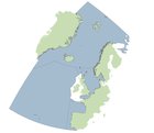
Deep-sea sponge aggregations comprise a range of habitats that are widely distributed across the OSPAR Maritime Area, being found in all Regions except Region III (Figure 1). They typically occur along continental shelves and slopes (upper bathyal), but are also found in deeper areas on oceanic ridges and islands, as well as offshore banks and seamounts (at lower bathyal depths), especially in Regions I and V. In some areas, such as Norwegian fjords (Region I) they can occur considerably shallower. At higher latitudes, sponge aggregations are also found in eastern Canada (Hudson Strait, Davis Strait, Baffin Bay, Newfoundland), whereas at lower latitudes some habitats are also known to occur along the Moroccan slope (northwest Africa) (Figure 1). Since the last assessment, knowledge of these habitats’ distribution has significantly expanded as a result of increasing surveying and data reporting efforts across all regions.
Method of assessment: 3b
 and ICES VME database (2021)")
Figure 1: Distribution of deep-sea sponge aggregations in the OSPAR maritime area, based on OSPAR T&D database (2018) and ICES VME database (2021)
Extent
The full extent occupied by sponge aggregations in the OSPAR Maritime Area is largely unknown given the relatively small geographical scales at which most surveys are conducted and due to the lack of systematic monitoring. However, habitat suitability models (HSMs) developed for Geodia spp. and Pheronema sponge aggregations, based on the occurrence of the characterizing species, predict these habitats to be widely distributed throughout the northern North Atlantic and the Arctic, and the temperate northeast Atlantic and Mediterranean Sea, respectively. These HSMs also show that the majority of Geodia grounds are likely to occur within the EEZs of Norway, Svalbard, Iceland, Greenland, and United Kingdom north of Shetland (Region I); and within the EEZs of Iceland (Region I), Spain (Region IV), the United Kingdom, Ireland and Azores (Region V). In the case of Pheronema grounds, considerably smaller proportions of suitable habitat is found in the areas beyond national jurisdiction. However, lack of comprehensive data on past and present extent of the habitat prevents an accurate assessment of the change in this criterion for the period considered (2010 to 2021).
Method of assessment: 3a.
Condition
The assessment of the condition (e.g., density, biomass, body-size distribution) of deep-sea sponge aggregations across the OSPAR Regions I, II, IV and V is quite challenging. This is mainly because baseline studies and monitoring for these habitats are very limited. A four-year study in the Schulz Bank, Arctic waters (Region I) showed a decrease in sponge density (e.g., in Geodia sp., Craniella sp.) in areas affected by human activities. Similar findings exist for the Porcupine Seabight (Region V) where decreases in the density, biomass and body diameter of Pheronema carpenteri have been found between 1983/4 and 2011. The condition of deep-sea sponge aggregations (morphological diversity; density and body-size distribution of Geodia and Phakellia) was enhanced in areas inside the Faroe-Shetland Channel Nature Conservation Marine Protected Area (Region II). Measures of genetic diversity based on hundreds of genomic markers indicate that Phakellia ventilabrum populations in the Cantabrian Sea, both in the Avilés Canyon and Le Danois Bank (Region IV) have lower genetic diversity than populations off Norway (Region I), Sweden (Region II), and much lower than in populations at Rockall Bank, on the Shetland Shelf and in the Faroe-Shetland Sponge Belt (Region V). Populations of Geodia hentscheli in Region I have similar levels of genetic diversity as Phakellia populations, with higher values of genetic diversity in populations on Vesterisbanken, Jan Mayen Ridge and Schulz Bank when compared with populations found in Iceland, Davis Strait, Svalbard, and Karasik Seamount.
Predictions of future trends (2020 to 2030) for the condition of deep-sea sponge aggregations are quite challenging. Models predict shifts in temperature, pH, oxygen and particulate organic carbon (i.e., food supply) in the bathyal zone (i.e., the zone where several deep-sea sponge aggregations have been found) for OSPAR Regions by 2100 under RCP8.5. Combining i) model predictions for abiotic/biotic conditions in bathyal habitats (see above); ii) scientific knowledge about the impacts of temperature, acidification, diet/feeding metabolism, it could be suggested that future environmental conditions in the OSPAR Maritime Area may contribute to the deterioration of the condition of deep-sea sponge aggregations. However, further research is needed to advance scientific knowledge on that front. The role of management measures (either in place or to be implemented - see section “Measures that address key pressures from human activities or conserve the species/habitat” for details) in the future condition of deep-sea sponge aggregations in all OSPAR Regions is expected to be positive. Direct evaluation of the role of these management measures in the conservation of the deep-sea sponge aggregations will be needed.
Method of assessment: 2c.
Threats and Impacts
The QSR 2010 identified disturbance of the seabed resulting from demersal fisheries as the main pressure (with “habitat damage” and “removal of target and non-target species” as key pressures). In the background document climate change was identified (alongside with trawling) as the most significant threat to the distribution of sponge aggregations in the long term. The current assessment identifies bottom trawling and climate change as the main pressures.
Fishing
Negative effects from bottom trawling have been clearly demonstrated for sponge habitats with extensive damage and little sign of recovery several years later. Pressure from fishing on this habitat appears to remain steady across the OSPAR Maritime Area (Figure 2 and Figure 3).

Figure 2: Relative change in fishing pressure across the OSPAR maritime area after introduction of the EU regulation 2016/2336
 before and (b) after introduction of the EU regulation 2016/2336, and (c) relative change in fishing pressure (years 2012 to 2016 vs 2017 to 2020) in cells known to contain records of deep-sea sponge aggregations. Based on data from the Global Fishing Watch aggregated to a resolution of 25km2.")
Figure 3: Habitat/Fishing pressure overlap across the OSPAR maritime area (a) before and (b) after introduction of the EU regulation 2016/2336, and (c) relative change in fishing pressure (years 2012 to 2016 vs 2017 to 2020) in cells known to contain records of deep-sea sponge aggregations. Based on data from the Global Fishing Watch aggregated to a resolution of 25km2.
The OSPAR Intermediate Assessment 2017 (Region V not assessed) showed that up to 86% of the grid cells assessed in the Greater North Sea and Celtic Seas (Regions II and III) show evidence of some physical disturbance of the seafloor from bottom contacting fishing gears, of which 58% of areas show higher levels of disturbance. From the assessed area 74% experienced consistent year-on-year pressure, likely affecting the ability of habitats to recover. Fishing pressure varied during the assessment period of 2010-2020 but there was no overall trend across regions. The overlap of OSPAR and ICES sponge aggregation occurrence data and Global Fishing Watch (an analysis which comes with various assumptions), suggests there has been little change on the overall impact of fishing on the habitat since 2016, when Regulation EU 2016/2336 was adopted. Within UK waters, regulation (EU) 2016/2336 is transposed into the Common Fisheries Policy and Aquaculture (Amendment etc.) (EU Exit) Regulations 2019, with the same fishing restrictions and prohibitions in place. In Region I the fishing pressure mainly decreases or remains unchanged. In Norwegian waters, Regulation 2011/755 restricts bottom fishing on vulnerable benthic habitats in areas deeper than 1 000 m in the Norwegian Economic Zone, including the Fisheries Protection Zone near Svalbard and in the Fisheries Zone at Jan Mayen. In Region II fishing pressure is mainly unchanged or decreases slightly. Region IV remains unchanged or shows a slight increase, while Region V is mainly unchanged with decrease in areas where bottom trawling is still allowed. However, with Regulation (EU) 2019/1241, large areas of Region V are under bottom trawling protection, which will decrease the fishing pressure in those areas.
 Relative change in fishing pressure in OSPAR Region II after introduction of EU regulation 2016/2336 and (b) change in fishing pressure in those cells known to contain records of deep-sea sponge aggregations. Based on data from the Global Fishing Watch aggregated to a resolution of 25km2")
Figure 4: (a) Relative change in fishing pressure in OSPAR Region II after introduction of EU regulation 2016/2336 and (b) change in fishing pressure in those cells known to contain records of deep-sea sponge aggregations. Based on data from the Global Fishing Watch aggregated to a resolution of 25km2
 Relative change in fishing pressure in OSPAR Region IV after introduction of EU regulation 2016/2336 and (b) change in fishing pressure in those cells known to contain records of deep-sea sponge aggregations. Based on data from the Global Fishing Watch aggregated to a resolution of 25km2")
Figure 5: (a) Relative change in fishing pressure in OSPAR Region IV after introduction of EU regulation 2016/2336 and (b) change in fishing pressure in those cells known to contain records of deep-sea sponge aggregations. Based on data from the Global Fishing Watch aggregated to a resolution of 25km2
Climate change
Although all OSPAR Regions are being affected by climate stressors, namely pH decrease, temperature increase, changes in POC flux and in dissolved oxygen, the contemporary and immediate future impacts on sponge aggregations are difficult to quantify. These habitats mainly occur in bathyal depths, at which the highest climate velocity is expected to occur under various climate change scenarios. The northernmost regions of the North Atlantic are predicted to experience the greatest impacts under worst-case scenario predictions. Increased temperature and lower pH will drastically reduce the suitable habitat for ecosystem-engineer species, and lead to declines in population densities, loss of biodiversity and reduced biogeographic distribution that might compromise connectivity at large scales and long-term survival. The reductions in carbon fluxes can in oligotrophic areas be even more serious. By 2100 predicted effects of climate change over deep-sea sponge aggregations are changes in distribution, extent and condition. Changes in circulation due to the slowdown of the Atlantic Meridional Overturning Circulation (which affects all OSPAR Regions) will have influence on regional and local circulation patterns which will also alter the patterns of population connectivity.
Measures that address key pressures from human activities or conserve the species/habitat
Since 2010, 34 nationally and collectively designated MPAs encompassing deep-sea areas have been designated (Regions I, II, IV, V) covering an area of nearly 551 000 km2. Of these, seven (spanning over 465 000 km2) are located in Areas Beyond National Jurisdiction (ABNJ), all in Region V. These encompass important deep-sea habitat topographic elements such as mid-ocean ridge and fracture zones (Charlie-Gibbs North and South, and MAR North of the Azores High Seas MPAs), as well as seamounts (Altair, Antialtair, Josephine, and the Milne seamount complex), which are likely to harbour sponge aggregations, although, at present, records are scarce for these areas. Two deep-sea MPAs (Avilés canyon system and Gulf of Cadiz mud volcanoes) have also been designated by Spain (Region IV). Despite the existing MPAs and NEAFC closure areas, the vast majority (nearly 72%) of the areas where deep-sea sponge habitats occur remains unprotected, with considerable variability across Regions. The proportion of records under protection (by one or both measures) varies between just 3% in Region I and 64% in Region II. In Regions IV and V, 32% and 47% of the records lay in areas currently under protection (Figure 6 and Figure 7). However, these values do not account for other protective actions taken beyond the scope of the OSPAR/NEAFC measures.

Figure 6: Deep-sea sponge aggregations distribution in relation to Marine Protected Areas and NEAFC bottom-fisheries closures in place across the OSPAR maritime area
 OSPAR Region I; (b) OSPAR Region II; (c) OSPAR Region IV; and (d) OSPAR Region V")
Figure 7: Proportion of deep-sea sponge aggregations within Marine Protected Areas and/or NEAFC closures in (a) OSPAR Region I; (b) OSPAR Region II; (c) OSPAR Region IV; and (d) OSPAR Region V
(i) Summarised information on implementation status of OSPAR measures
Actions towards the recommendations were summarised below using the 2019 implementation reports (submitted by France, Iceland, Ireland, Norway, Spain and the UK) together with additional information from Contracting Parties. Together these submissions provide information on parts of the Arctic Waters (I), Greater North Sea (II), Celtic Seas (III), the Bay of Biscay and Iberian Coast (IV), and the Wider Atlantic (V):
3.1.a Protection for Deep-Sea Sponge Aggregations is covered by the environmental objectives for the implementation of the Marine Strategy Framework Directive (MSFD). Specifically, the objectives "Reduce physical disturbance and physical loss of broad and particular habitats linked to maritime works, activities and uses", and "Prevent abrasion and smothering of the most representative areas of deep habitats (VME) and reduce abrasion on particular geomorphological structures" have direct relevance to Deep-Sea Sponge Aggregations. These habitats are also covered under the Habitats Directive [92/42/EEC]. Additionally, Deep-Sea Sponge Aggregations are legally protected under the following European legislation:
- European Communities (Birds and Natural Habitats) Regulations (2011-2015);
- European Union (Birds and Natural Habitats) (Sea-Fisheries) Regulations (2013-2014).
The United Kindgom has designated six offshore Special Areas of Conservation to protect EU Habitats Directive listed Reef habitat and associated vulnerable marine ecosystems; at least four of these sites are known to contain Deep-sea sponge aggregations. Within these SAC sites fishing with bottom trawls is prohibited below 800 m depth; pelagic fishing that excludes contact with the seafloor or benthic features is permitted. Deep-Sea Sponge Aggregations may be the subject of a prefectural order for the protection of natural habitats in metropolitan France under this Directive.
The new EU Biodiversity Strategy for 2030 (adopted in May 2020) aims to strengthen the protection of marine ecosystems and to restore them to achieve “good environmental status”, including tackling practices that damage the seabed.
National legislation for the protection for Deep-Sea Sponge Aggregations in the United Kingdom has been through:
- The Conservation of Habitats and Species Regulations 2017;
- The Conservation (Natural Habitats, &c) Regulations (Northern Ireland) 1995 (as amended);
- The Conservation (Natural Habitats &c) Regulations (Scotland) 1994 (as amended);
- The Conservation of Offshore Marine Habitats and Species Regulations 2017;
- The Marine and Coastal Access Act 2009;
- The Marine (Scotland) Act 2010;
- Nature Conservation (Scotland) Act 2004.
Furthermore, the United Kingdom has adopted regulations prohibiting fishing in waters deeper than 1 000 m, and require reports catches of deep-sea sponges in shallower waters and to move away if catches exceed a set threshold value.
Closures for bottom-contact fishing operations in further areas of deep-sea sponge aggregations have been implemented in Region V through the NEAFC Recommendation 19 2014: Protection of VMEs in NEAFC Regulatory Areas, as amended by Recommendations 09:2015 and 10:2018.
Iceland has banned fishing with trawls in four areas where Deep-Sea Sponge Aggregations are known to occur (regulation No 959/2019) and in Norway regulations have been put in place since 2011 applicable to all fishing gear likely to touch the seafloor during normal operations in all waters under Norwegian fisheries jurisdiction. Assessments were done and the 2011 regulations were amended as of July 2019 establishing some closed areas around Svalbard and prohibited fishing deeper than 800 m in the same area.
3.1.b The effectiveness of the existing management measures for the protection of Deep-Sea Sponge Aggregations have not been directly evaluated. A Norwegian national red list assessment reviewed the status of key species and habitats and in 2018 considered Deep-Sea Sponge Aggregations with Geodia as ‘near threatened’. The El Cachucho MPA is included in the OSPAR MPA Network. Its management plan (2011-2017) included actions to prevent Deep-Sea Sponge Aggregations from the impact of fisheries and other possible pressures. The assessment of their effectiveness conducted by the Spanish Institute of Oceanography (IEO) concluded that these measures have been effective. In the UK, management for the protection of Deep-Sea Sponge Aggregations occurs through United Kingdom legislation implementing the EC Habitats Directive and via fisheries closure through the Common Fisheries Policy and North East Atlantic Fisheries Commission (NEAFC), the latter in Region V. There is evidence from monitoring of fishing activity that fishermen are obeying these closures to a very large extent. In Ireland's maritime area management measures for the protection of Deep-sea Sponge Aggregations are considered to be effective where these features are conserved by existing area-based protection (i.e., Special Areas of Conservation) or fishing restrictions.
3.1.c Monitoring, surveillance, and mapping programmes to determine the extent, distribution and condition of Deep-sea Sponge Aggregations have been reported by Iceland, Ireland, Spain, Norway and the United Kingdom.
3.1.d The EU deep-sea regulation (https://eur-lex.europa.eu/eli/reg/2016/2336/oj), introduced in 2016, includes obligations for increased monitoring and reporting of VME (including sponges) bycatch by vessels trawling in waters between 400-800 m. Fishing vessels encountering VMEs are obligated to report the event to national competent authorities and these data are used to inform VME mapping. The explicit involvement of commercial fishermen in data collection for research and monitoring purposes also has occurred in Iceland, Norway, Spain and the United Kingdom. Sponge identification guides have been developed to aid reporting in Iceland. In Spain, the draft management plan for the El Cachucho MPA includes establishing arrangements between the Spanish Institute of Oceanography and the fisheries sector to monitor and assess the management measures, with scientific observers on board.
3.1.e Collection of information on fishing activities has been improved. Vessel Monitoring System (VMS) data are used to map fishing effort at higher resolution, and to assess the risk of damage to vulnerable habitats. In Norway these data products are available to the public. In the United Kingdom, VMS data are available for all vessels over 12 m fishing in United Kingdom's waters. The SIFIDS project in Scotland aims to determine the movements and numbers of fishing vessels not monitored by VMS (i.e., < 15 m), leading to an integrated system for the collection, collation, analysis and interrogation of data from the inshore fishing fleet and enhance the evidence for management decisions (https://www.masts.ac.uk/research/emff-sifids-project/). Consultations on the introduction of inshore Vessel Monitoring System (iVMS) and increased catch recording for the English and Welsh under 12 m fleet were undertaken in 2018/2019 and are expected to be rolled out in the coming years. Consultation for iVMS in Northern Ireland is expected at a later date.
3.1.f Records of Deep-sea Sponge Aggregations are regularly submitted to OSPAR and ICES in response to their respective data calls. New SeaRover survey data concerning all Deep-sea Sponge Aggregations encountered in 2017, 2018 and 2019 will be reported by Ireland to the OSPAR habitat mapping database in due course. It is anticipated that these data will significantly augment the data from Ireland that are already held in the OSPAR database.
3.1.g&h In addition to the general protections afforded to deep sea habitats where sponges co-occur with other benthos, three countries have reported protections put in place to specifically protect deep-sea sponges. In France, Deep-sea Sponge Aggregations are a protected feature (Habitat 1170 Reefs) in a Natura 2000 site designated in 2017 (FR5302015 - Mers Celtiques - Talus du golfe de Gascogne). In Spain, Deep-sea Sponge Aggregations provided justification of the El Cachucho, MPA, as well as the designation of the SCIs Banco de Galicia, Volcanes de fango del golfo de Cádiz and Sistema de cañones submarinos de Avilés, which host this habitat, in 2014. In the United Kingdom, Deep-sea Sponge Aggregations are protected as part of Annex I reef features in two Special Area of Conservation (SACs), and as a feature within four Nature Conservation Marine Protected Areas in Scottish waters. All these MPAs have been formally notified as OSPAR MPAs. The development of management plans for these areas has begun but plans are not yet adopted.
3.1.i Potential impacts of fishing on Deep-sea Sponge Aggregations have been explicitly analysed by Spain, in the framework of the implementation of the MSFD, by calculating the number of points significantly affected by all existing pressures within Spanish jurisdictional waters. All reporting Contracting Parties work through ICES and/or NEAFC to assess impacts of fishing on vulnerable marine ecosystems (VMEs), including Deep-sea Sponge Aggregations. ICES has most recently completed a general assessment of fishing overlap in relation to VMEs, in response to a request from the EU (https://www.ices.dk/sites/pub/Publication%20Reports/Advice/2021/Special_Requests/eu.2021.01.pdf).
(ii) Actions taken beyond the scope of the OSPAR measure
In 2006, the United Nations General Assembly called upon States to take action through Regional Fisheries Management Organisations (RFMOs) to, inter alia, protect vulnerable marine ecosystems (VMEs) from destructive fishing practices and prevent significant adverse impacts (SAIs) (UNGA Resolution 61/105). VMEs and SAIs are further defined in FAO (2009) and VMEs include the OSPAR habitats deep-sea sponge aggregations, coral gardens, cold-water coral reefs, seamounts and hydrothermal vents/fields.
Within the North-East Atlantic Fisheries Commission (NEAFC) Regulatory Area, measures to protect VMEs include the implementation of bottom fishing closure areas and the use of “move-on” rules for fishing vessels, related to encounters of specific quantities of VME indicators within by-catch from bottom-contacting gears. For sponge aggregations, threshold levels are 400 kg of live sponge for a trawl tow (800 kg in 2010) and the presence of sponge VME indicators on 10 hooks per 1 000 hook segment or per 1 200 m section (for a longline set) (NEAFC Recommendation 19 2014). Currently, there are 13 VME closures in place covering an area of 374 000 km2 (all in Region V). Three of the closures (Edora’s Bank, Hatton-Rockall Basin and Hatton Bank 2) were implemented after the 2010 assessment, representing an increase of approx. 14 800 km2 ,3.9%). All closures currently in place will be reviewed in 2022.
Within EU waters, Regulation (EU) 2016/2336 restricts bottom fishing >400 m to the 2009-2011 fishing footprint, prohibits bottom fishing >400 m where VMEs are known or likely to occur (through designation of VME closures) and places a complete ban on bottom trawling deeper than 800 m. Within UK waters, regulation (EU) 2016/2336 is transposed into the Common Fisheries Policy and Aquaculture (Amendment etc.) (EU Exit Regulations 2019), with the same fishing restrictions and prohibitions in place. In Norwegian waters, Regulation 2011/755 restricts fishing with bottom gear on vulnerable benthic habitats in areas deeper than 1 000 m in the Norwegian Economic zone, including the Fisheries Protection Zone near Svalbard, and the Fisheries Zone around Jan Mayen.
Council regulation no. 1568/2005 established a ban on the use of bottom-contacting gears (gillnet, entangling and trammel nets, bottom trawl or similar towed nets) at depths below 200 m in certain areas of the Atlantic Ocean including the Azores archipelago (region V).
In Portugal, since 2016, the Marine Park of the Azores which is currently constituted by 17 MPAs, covers an area of approximately 246 000 km2 (Decreto Legislativo Regional n.º 28/2011/A, modified by the Decreto Legislativo Regional n.º 13/2016/A and Portaria n.º 68/2019).
In Swedish MPAs Bratten and Kosterfjorden-Väderöfjorden fisheries regulation measures for e.g. Deep-sea Sponge Aggregations have been implemented (via EU Common Fisheries Policy). Both Bratten and Kosterfjorden-Väderöfjorden have managements plans and adaptive management.
Conclusion (including management considerations)
The overall condition of deep-sea sponge aggregations is considered to be deteriorating across all OSPAR Regions due to persistent impacts from bottom fisheries over time, and the habitat's high sensitivity to such impacts. Impacts from climate change are difficult to assess but presumed to become detrimental in the future, alongside other emerging pressures such as deep-sea mining.
Deep-sea sponge aggregations continue to meet the Texel-Faial criteria, and new research further emphasises their regional and global importance, as well as ecological significance and sensitivity.
Various area-based management tools (OSPAR MPAs) and other effective conservation measures (NEAFC closures) have been developed, but these are largely located in ABNJ (in Region V) whereas most of the habitat occurs within countries’ EEZs resulting in a large proportion of the habitat (72%) being unprotected. Increased protection in Region I, an area for which there is a particularly good knowledge base of this habitat distribution and functioning, is desirable.
Status re-assessments should be performed on mid- to long-term cycles (6-10 years) to allow for substantial new data to be collected and changes in condition and recovery arising from the establishment of protection areas to be noticeable.
Knowledge Gaps
Deep-sea sponge aggregations comprise a range of habitats differing in community composition and structure as well as spatial and bathymetric distributions. At higher latitudes, sponge aggregations dominated by tetractinellid sponges (Geodia spp., Stelletta spp., Stryphnus sp.) are widely distributed spanning across the northern Atlantic and the Arctic regions whereas at lower latitudes different types of aggregations are usually patchier in distribution and restricted to considerably smaller areas (a few ecoregions). Defining the different types of sponge habitats (biotopes) and considering them separately in future assessments would be beneficial. This would facilitate the assessment and understanding of distribution/extent through development of ‘type’ (biotope) specific habitat models. Further data are required on distribution from undersampled areas, density (in order to establish presence of aggregations), and drivers of distribution.
Knowledge on baseline conditions (in “pristine” areas) and natural variability is lacking making it difficult to assess changes, and except for a few areas (such as the Barents Sea - Region I), monitoring data are largely lacking. Establishing long-term monitoring programmes in selected stations as well as through multi-annual demersal fisheries surveys conducted by contracting parties could be a way forward. Local ecological knowledge of demersal fishers is also an untapped source of data that could further inform both distribution and extent as well as changes and recent trends.
Understanding potential responses to the climate-related threat would benefit from collection of fundamental life history characteristics and physiological data across climate-related variables. In terms of life history characteristics major knowledge gaps exist regarding the nature, behaviour and distribution of deep-sea sponge larvae as well as how changes in ocean circulation (e.g., basin scale shifts and environmental conditions) affect larval distribution and connectivity among deep-sea sponge populations. More generally, information on genetic connectivity between sponge grounds is lacking. Longevity, growth rates, fecundity and reproductive patterns are also important population dynamic gaps that are fundamental to model and predict effects on the populations and habitats.
Furthermore, experimental work assessing the (synergistic) impacts of climate-related stressors on the health of deep-sea sponges will substantially advance the scientific knowledge about the status of deep-sea sponge aggregations under future environmental conditions.
Agreement on the scientific indicators to be used for the assessment of the status of deep-sea sponge aggregations (e.g., density, biomass, areal coverage), use of common measurement units, deposition of collected (meta)data in online repositories (e.g., ICES VME database, GBIF, OBIS, EMODnet, PANGAEA) and making publications available in open access will play an important role in future progress.
Method used
Main source of information:
- OSPAR data assessment only
- Assessment derived from third party assessment
- Assessment derived from a mix of OSPAR data assessment and assessments from third parties
Assessment is based upon:
a) complete survey or a statistically robust estimate (e.g. a dedicated mapping or survey or a robust predictive model with representative sample of occurrence data, calibration and satisfactory evaluation of its predictive performance using good data on environmental conditions across entire species range);
b) based mainly on extrapolation from a limited amount of data (e.g. other predictive models or extrapolation using less complete sample of occurrence and environmental data);
c) based mainly on expert opinion with very limited data;
d) insufficient or no data available.
Extent:
Burgos JM, Buhl-Mortensen L, Buhl-Mortensen P, Ólafsdóttir SH, Steingrund P, Ragnarsson SÁ, Skagseth Ø (2020) Predicting the Distribution of Indicator Taxa of Vulnerable Marine Ecosystems in the Arctic and Sub-arctic Waters of the Nordic Seas. Front. Mar. Sci. 7:131.
Howell KL, Piechaud N, Downie AL, Kenny A (2016) The distribution of deep-sea sponge aggregations in the North Atlantic and implications for their effective spatial management. Deep-Sea Research I 115, 309–320.
Ross RE, Howell KL (2013) Use of predictive habitat modelling to assess the distribution and extent of the current protection of ‘listed’ deep-sea habitats. Diversity and Distributions 19, 433–445.
Condition:
Beazley L, Kenchington E, Murillo JM, Brickman D, Wang Z, Davies AJ, Roberts EM, Rapp HT (2021) Climate change winner in the deep sea? Predicting the impacts of climate change on the distribution of the glass sponge Vazella pourtalesii. Mar. Ecol. Prog. Ser. 657: 1-23.
Bell JB, Alt CHS, Jones DOB (2016) Benthic megafauna on steep slopes at the Northern Mid-Atlantic Ridge. Marine Ecology 37, 1290-1302.
Bennett HM, Altenrath C, Woods L, Davy SK, Webster NS, Bell JJ (2017) Interactive effects of temperature and pCO2 on sponges: from the cradle to the grave. Glob. Change Biol. 23, 2031-2046.
Brito-Morales, I., Schoeman, D.S., Molinos, J.G., Burrows, M.T., Klein, C.J., Arafeh-Dalmau, N., Kaschner, K., Garilao, C., Kesner-Reyes, K. and Richardson, A.J., 2020. Climate velocity reveals increasing exposure of deep-ocean biodiversity to future warming. Nature Climate Change, 10(6), pp.576-581.
Busch K, Taboada S, Riesgo A, Koutsouveli V, Rios P, Cristobo J, Franke A, Getzlaff K, Schmidt C, Biastoch A, Hentschel U (2021) Population connectivity of fan-shaped sponge holobionts in the deep Cantabrian Sea. Deep Sea Res. 167:103427.
Cathalot C, van Oevelen D, Cox TJS, Kutti T, Lavaleye M, Duineveld G, Meysman FJR (2015) Cold-water coral reefs and adjacent sponge grounds: hot spots of benthic respiration and organic carbon cycling in the deep sea. Front. Mar. Sci. 2:37. doi: 10.3389/fmars.2015.00037
de Kluijver A, Bart MC, van Oevelen D, de Goeij JM, Leys SP, Maier SR, Maldonado M, Soetaert K, Verbiest S, Middelburg JJ (2021) An integrative model of carbon and nitrogen metabolism in a common deep-sea sponge (Geodia barretti). Front. Mar. Sci 7:596251.
Dinwoodie K, Perry J, Last EK, Robson LM (2021) Pheronema carpenteri field on Atlantic lower bathyal mud. In Tyler-Walters H. and Hiscock K. (eds) Marine Life Information Network: Biology and Sensitivity Key Information Reviews, [on-line]. Plymouth: Marine Biological Association of the United Kingdom. [cited 29-10-2021]. Available from: https://www.marlin.ac.uk/habitat/detail/1232
FAO (2009) The FAO International Guidelines for the Management of Deep-sea Fisheries in the High Seas. Activities pages. In: FAO Fisheries and Aquaculture Department [online]. Rome. Updated 30 April 2013. http://www.fao.org/fishery/topic/166308/en
IPCC (2019) Summary for Policymakers. In: IPCC Special Report on the Ocean and Cryosphere in a Changing Climate [H.-O. Pörtner, D.C. Roberts, V. Masson-Delmotte, P. Zhai, M. Tignor, E. Poloczanska, K. Mintenbeck, M. Nicolai, A. Okem, J. Petzold, B. Rama, N. Weyer (eds.)].
Kazanidis G, van Oevelen D, Veuger B, Witte UFM (2018) Unravelling the versatile feeding and metabolic strategies of the cold-water ecosystem engineer Spongosorites coralliophaga (Stephens, 1915). Deep-Sea Res. I 141:71-82.
Kazanidis G, Vad J, Henry L-A, Neat F, Berx B, Georgoulas K and Roberts JM (2019) Distribution of Deep-Sea Sponge Aggregations in an Area of Multisectoral Activities and Changing Oceanic Conditions. Front. Mar. Sci. 6:163. doi: 10.3389/fmars.2019.00163
Klitgaard AB, Tendal OS (2004) Distribution and species composition of mass occurrences of large-sized sponges in the northeast Atlantic. Prog. Oceanogr. 61:57-98.
McIntyre FD, Drewery J, Eerkes-Medrano D, Neat FC (2016) Distribution and diversity of deep-sea sponge grounds on the rosemary bank seamount. NE Atlantic. Mar. Biol. 63, 142–152. doi: 10.1007/s00227-016-2913-z
Morrison KM, Meyer HK, Roberts EM, Rapp HT, Colaço A and Pham CK (2020) The First Cut Is the Deepest: Trawl Effects on a Deep-Sea Sponge Ground Are Pronounced Four Years on. Front. Mar. Sci. 7:605281. doi: 10.3389/fmars.2020.605281
Puerta P, Johnson C, Carreiro-Silva M, Henry L-A, Kenchington E, Morato T, Kazanidis G, Rueda JL, Urra J, Ross S, Wei C-L, González-Irusta JM, Arnaud-Haond S and Orejas C (2020) Influence of Water Masses on the Biodiversity and Biogeography of Deep-Sea Benthic Ecosystems in the North Atlantic. Front. Mar. Sci. 7:239. doi: 10.3389/fmars.2020.00239
Purser A, Orejas C, Gori A, Tong R, Unnithan V, Thomsen L (2013) Local variation in the distribution of benthic megafauna species associated with cold-water coral reefs on the Norwegian margin. Cont. Shelf Res. 54, 37–51. doi: 10.1016/j.csr.2012.12.013
Robertson LM, Hamel JF, Mercier A (2017) Feeding in deep-sea demosponges: Influence of abiotic and biotic factors. Deep-Sea Res. I 127:49-56.
Strand R, Whalan S, Webster NS, Kutti T, Fang J KH, Luter HM, Bannister RJ (2017) The response of a boreal deep-sea sponge holobiont to acute thermal stress. Sci. Rep. 7:1660. doi: 10.1038/s41598-017-01091-x
Sweetman K, Thurber AR, Smith CR, Levin LA, Mora C, Wei C.-L, Gooday AJ, Jones DOB, Rex M, Yasuhara M, Ingels J, Ruhl HA, Frieder CA, Danovaro R, Würzberg L, Baco A, Grupe BM, Pasulka A, Meyer KS, Dunlop KM, Henry L.-A, Roberts JM (2017) Major impacts of climate change on deep-sea benthic ecosystems. Elem. Sci. Anth. 5:4.
Thornalley DJR, Oppo DW, Ortega P, Robson JI, Brierley CM, Davis R, Hall IR, Moffa-Sanchez P, Rose NL, Spooner PT, Yashayaev I, Keigwin LD (2018) Anomalously weak Labrador Sea convection and Atlantic overturning during the past 150 years. Nature 556:227-230.
van Duyl FC, Hegeman J, Hoogstraten A, Maier C (2008) Dissolved carbon fixation by sponge–microbe consortia of deep water coral mounds in the northeastern Atlantic Ocean. Mar. Ecol. Prog. Ser. 358:137–150.
Vieira R, Bett BJ, Jones DOB, Durden JM, Morris KJ, Cunha MR, Trueman CN, Ruhl HR (2020) Deep-sea sponge aggregations (Pheronema carpenteri) in the Porcupine Seabight (NE Atlantic) potentially degraded by demersal fishing. Prog. Oceanogr. 183, 102189.
Threats and impacts:
Brito-Morales, I., Schoeman, D.S., Molinos, J.G., Burrows, M.T., Klein, C.J., Arafeh-Dalmau, N., Kaschner, K., Garilao, C., Kesner-Reyes, K. and Richardson, A.J., 2020. Climate velocity reveals increasing exposure of deep-ocean biodiversity to future warming. Nature Climate Change, 10(6), pp.576-581.
Buhl-Mortensen, L., Ellingsen, K. E., Buhl-Mortensen, P., Skaar, K. L., and Gonzalez-Mirelis, G. (2016). Trawling disturbance on megabenthos and sediment in the Barents Sea: chronic effects on density, diversity, and composition. ICES J. Mar. Sci. 73, 98–114. doi: 10.1093/icesjms/fsv200
Morrison KM, Meyer HK, Roberts EM, Rapp HT, Colaço A and Pham CK (2020) The First Cut Is the Deepest: Trawl Effects on a Deep-Sea Sponge Ground Are Pronounced Four Years on. Front. Mar. Sci. 7:605281. doi: 10.3389/fmars.2020.605281
Puerta P, Johnson C, Carreiro-Silva M, Henry L-A, Kenchington E, Morato T, Kazanidis G, Rueda JL, Urra J, Ross S, Wei C-L, González-Irusta JM, Arnaud-Haond S and Orejas C (2020) Influence of Water Masses on the Biodiversity and Biogeography of Deep-Sea Benthic Ecosystems in the North Atlantic. Front. Mar. Sci. 7:239. doi: 10.3389/fmars.2020.00239
Vieira R, Bett BJ, Jones DOB, Durden JM, Morris KJ, Cunha MR, Trueman CN, Ruhl HR (2020) Deep-sea sponge aggregations (Pheronema carpenteri) in the Porcupine Seabight (NE Atlantic) potentially degraded by demersal fishing. Prog. Oceanogr. 183, 102189.
Knowledge gaps:
Kazanidis, G., Orejas, C., Borja, A., Kenchington, E., Henry, L.-A., Callery, O., Carreiro-Silva, M., Egilsdottir, H., Giacomello, E., Grehan, A., Menot, L., Morato, T., Ragnarsson, S. A., Rueda, J. L., Stirling, D. E., Stratmann, T., van Oevelen, D., Palialexis, A., Johnson, D., & Roberts, J. M. (2020). Assessing the environmental status of selected North Atlantic deep-sea ecosystems. Ecological Indicators, 119, 106624.
Sheet reference:
BDC2022/Deep-sea_Sponge_Aggregations_OSPAR